|
|
Gadigal clan of coastal Dharug
|
|
|
|
|
|
|
Redfern stands on Gadigal land. These snippets are temporary until more is available. Gadi land extended from Burrawara (South Head) through to Warrane (Sydney Cove), Gomora (Cockle Bay-Darling Harbour) possibly to Blackwattle Creek, taking in the wetland sand and dunes now known as Redfern, Erskineville, Surry Hills and Paddington, down to the Cook's River. Some say Cadi (gadi) was the name of the grass trees and the name of the freshwater creek at Camp Cove, others that it may have been Kutti (Watson's Bay).
1789 May Sorry business 'According to Bennelong, the Cadigal clan – which might have numbered 50 or more men, women and children in 1788 – was reduced to only three people by the deadly smallpox epidemic in April 1789. The survivors were 'Cole-be, his nephew 'Nan-bar-ray' (Nanbarry) and ... Caruey / Gur-roo-ee.' Dictionary of Sydney
The neighbouring Cameragal (N), Wangal (W) and Gameygal (S) were also devastated.
Colebee c1760- 1806
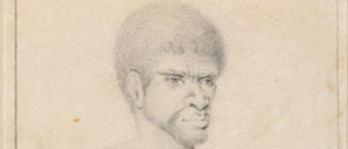
Thomas Watling, c1792–97. © Natural History Museum, London - 022030
another possible picture of Colebee is at https://dictionaryofsydney.org Wife 1 - Daringa - daughter: Panieboollong, died 1791-92 daughter: name unknown, died c.1795
Wife 2 - Boorea [Cammeraigal?] - no known children
Wife 3 - Kurubarabulu [Gweagal] - no known children
Daringa, Colebee's wife c1770-1795
[a Murro-ore-dial woman], & child
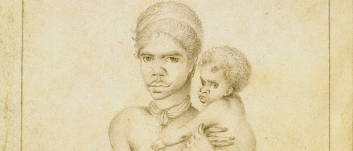
Portrait of an Aboriginal woman, named Da-ring-ha, and a child,
Thomas Watling, c1792–97. © Natural History Museum, London
Gur-roo-ree / Caruey ?-1805
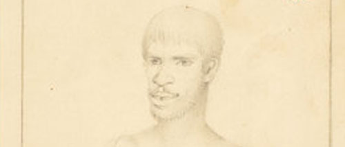
Thomas Watling, c1792–97. © Natural History Museum, London
Nanbaree c1790-1821
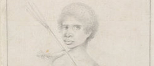
Thomas Watling, c1792–97. © Natural History Museum, London
Early 1800s gathering ground … The municipality of Redfern… was known as ‘Boxley’s Clear’ [c.1818] … farm was the only cleared spot amidst the scrub which everywhere abounded. Nearly all over the present Redfern grew luxuriant crops of geebungs and five-corners … Boxley’s Clear was a great rendezvous of the blacks … and was one of their great feasting grounds as well as the scene of many hard-fought battle … the Governor gave instruction that no waddies or spears were to be brought within a mile of the boundaries of the town [so] the clearing at Redfern, being nicely adjacent, was chosen by the natives as the place of meeting for the settlement of disputes, in lieu of the Racecourse [Hyde Park] … The portion of Redfern, known as Albert Ground and Victoria Town, as well as the vacant paddocks opposite Elizabeth Street [Redfern Park] was known as Boxley’s lagoon … Round the edges of the clear were the camping grounds … Obed West 1883 in Trove
[Boxley was a convict who purchased robert's grant between today's Cleveland and Redfern Streets across to Botany Street. It was sold to Laycock, then included in Redfern's 'grant' in 1816.]
Ceremony Traditional ceremonies were discouraged in the town. An article appearing in the Sydney Echo in June 1890 described the corroborees and camps of an earlier period: ‘There are people living who recollect when the Cleveland Paddocks, where the railway station and the Exhibition Building now stand, were a favourite place for the blacks. Then their ‘corroborees’ kept the few residents of Redfern awake till far into the night. By degrees the camps were driven back into Waterloo and Alexandria, until the blacks….have all gone.’ ‘The Suburbs of Sydney. No. VIII-Waterloo and Alexandria’, Sydney Echo, 12 June, 1890. Mitchell Library, Newspaper Cuttings, Volume 159, pp.35.7. in North Eveleigh Heritage Impact Statement.
Gadigal transit routes to Botany Bay and Cooks River Sydney’s coastal Aboriginal clans burned and maintained one-metre wide paths. Obed West, who often hunted with Aboriginal people at Botany Bay during the 1830s, wrote in the Sydney Morning Herald (1882): The blacks called Long Bay 'Boora', and it was long before white men came to this country; and for long afterwards, the principal camping place for the aboriginal [people] between Sydney [and Botany Bay]. Several well-beaten paths led down to the bay. One notable path, which ran from Blackwattle Creek at the Brickfields Village (now Chippendale) southwards to the north shore of Botany Bay, was the forerunner of Botany Road. Keith Vincent Smith in Moorooboora's daughter
http://www.nla.gov.au/pub/nlanews/2006/jun06/article5.html
|
|
|
 |
| |
|
|
7 October 2023 - 28 January 2023
|
|
|
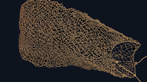
Back on Country after 200 years @ State Library
|
|
|
 |
As the Gadigal had an oral history, and few, if any, lived to tell the story, writings and drawings from the British and French are used here. Of course the Brits had their own ethnocentric perspectives. Viewing some of this may cause grief and sorrow to the new residents of Redfern and surrounds who wish to know more of their forebears. However, as restricted as they are, they tell a little of the story, the people and the landscape before it was completely cleared. Some of the pictures are magnificent, but of course raise more questions than they answer, and the untold story is heartbreaking. Some reflect reality, others were symbolic or stereotyped. Some of the information is helpful, but is patchy, imperfect and inadequate, occasionally dubious - the inability to understand a product of the time and culture. Some people have the knowledge that is passed on orally. This is for people who do not have access to that, and wish to know a little more. It has not been verified yet, and is incomplete.
|
|
|
 |
|
|
2022 - Pemulwuy, Bidjigal in The Australian wars NITV

2023 - Woollarawarre Bennelong, Wangal [1764 - 1813]
Bennelong revealed - podcast
|  |
|
|
|
|
 |
 |
| |
Terms Of Use
|
Privacy Statement
|
Copyright (c) 2026 Redfern Oral History
|
Register
|
Login |
Website Solution: Pixel Alchemy
|
|